Big Caliente Hot Springs
105–115°F
Pool temperatures
Hike
Moderate access
Free
No fee reported
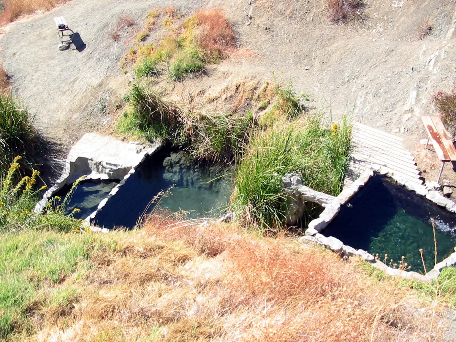
Big Caliente is a hot spring in the Los Padres National Forest mountains north of Santa Barbara. The water comes out at about 115 F and fills a concrete-modified soaking pool, with a second primitive pool further up the creek. A picnic site and pit toilet are nearby. The road in is rough and often gated, so many visitors hike or bike.
01 · Before you go
Plan your visit
What to expect on the ground: rules, facilities and when to go.
- Camping nearbyThe USFS says camping facilities are a short distance from the springs. One guide names Rock Camp, under half a mile from the Little Caliente site. Staying at the spring itself is not allowed because it is day-use only.
- Picnic area & toilets
- 2 pools
- Hours6 am to 10 pm daily, per a third-party guide
- SeasonThe dirt road (5N16) is closed to vehicles when rain is forecast or after storm and fire damage. The gate has been reported closed even in dry weather. Hiking, biking and horseback riding stay open on the closed road.
- Free to soakNo day-use fee is reported. An Adventure Pass is reported to be needed for overnight stays in the forest.
Best time to go. Spring, summer and fall, when the road is more likely to be passable. Avoid it around rain, when the road closes.
02 · Live
Conditions
Access status, weather and hazards. Closure feeds are checked automatically every morning.
Checked 14 Oct · updated daily
Forest roads to the Caliente springs are adobe clay and gates are closed ahead of wet weather, and past storm damage has limited vehicle access. No 2026 status was found. Check with the Santa Barbara Ranger District (805-967-3481) before visiting.
The road is impassable when wet. Fire and landslide damage has closed the road in the past. The Santa Ynez River crossing on the Blue Canyon route may be a problem. Water comes out hot at the source and valves adjust the temperature.
03 · Route
Getting there
Nearest town: Santa Barbara.
- 1
From Santa Barbara, take Highway 154 to the summit of San Marcos Pass. Turn east onto East Camino Cielo and follow it about 23 miles to Pendola Station.
- 2
Just past the station, turn north onto Forest Road 5N16 (the USFS brochure writes it as 5N15). Follow it about 3 miles to the springs and picnic area.
- 3
Where the road gate is closed, walk or bike in. One trip report describes parking at Romero Saddle, where the pavement ends, and hiking the Romero Trail and Blue Canyon Trail to the Romero-Camuesa Road.
- 4
That route needs a Santa Ynez River crossing and a climb up to the springs. The larger concrete pool sits by the old parking area, and a second pool is a few hundred yards up the creek.
34.5380, −119.5600 · nearest town Santa Barbara, CA
04 · Where to stay
Stay nearby
Start early and stay close. Places to stay near Santa Barbara, from campgrounds to cabins.
If you book through these links we may earn a small commission, at no extra cost to you. It never affects what we list or how.